What is your research focus?
I study how freshwater ecosystems—especially riparian zones along rivers, streams, and lakes—support water security, biodiversity, and ecological resilience, and how to map and monitor them at actionable scales. In 2023, 59 countries and the European Union launched the Freshwater Challenge to restore 300,000 km of rivers and 350 million ha of wetlands by 2030. A key gap is consistent, high-resolution mapping to turn national pledges into place-based targets. To help fill this, I co-led a global 30-meter map of priority freshwater areas—combining land cover, river networks, floodplains, and wetlands—to show where protection and restoration would yield the greatest benefits.
My current questions build on that foundation: Where are freshwater ecosystems most at risk? How do riparian buffers influence water quality? How are they changing over time, and how can we guide conservation? Methodologically, I fuse radar (Sentinel-1; NISAR), optical (Landsat, Sentinel-2), and lidar (GEDI) with AI, including geospatial foundation models (large AI models pre-trained on satellite imagery) to produce dynamic, 30-m maps of riparian zones and wetlands across the U.S. I then link riparian condition to freshwater-quality indicators—chlorophyll-a, turbidity, and water clarity—to help partners such as USDA–NRCS set conservation targets, monitor restoration outcomes, and refine policy. Internationally, these datasets provide the high-resolution, place-based evidence needed to operationalize the Freshwater Challenge along rivers, floodplains, and headwaters.
How did you end up working at NASA Goddard?
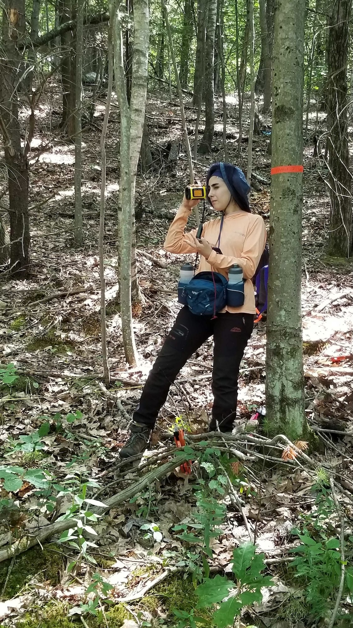
I started my Ph.D. with Dr. Narendra Das, who led the SMAP radar mission at JPL. That mentorship opened doors across NASA: I contributed to SERVIR—a NASA/USAID program that helps countries use satellite data for climate and disaster decisions—joined SMAPVEX22, a field campaign collecting ground measurements to validate NASA’s soil-moisture satellite (SMAP) and spent a month at Harvard Forest doing intensive soil-moisture and vegetation sampling. Those experiences plugged me into the NASA community and steered my research toward missions like NISAR (NASA–ISRO Synthetic Aperture Radar) and Landsat.
In my second year of my PhD, I made a pivotal choice. I was running 12-day field campaigns to measure soybean and corn water content, synchronized with Sentinel-1 satellite revisits. I wanted to use AI to estimate vegetation water content, but the in-situ data were too sparse for data-hungry deep learning models. So, I stepped out of my comfort zone: I took one of the toughest computer-science courses, then co-authored a paper with a CS faculty member, which gave me a solid footing in deep learning. I also wrote a comprehensive review on Synthetic Aperture Radar (SAR) and deep learning in agriculture, reading over 100 papers—painful at times, but transformative. That work led to a collaboration with Dr. Hamed Alemohammad on geospatial foundation models (GFMs). With GFMs, we showed how to learn from limited ground data to develop a generalized model for a large scale—turning what seemed impossible into practical methods.
When a position opened in Goddard’s Hydrological Sciences Laboratory (Code 617), I applied and was selected by Dr. John Bolten. I’m now building on that mix of fieldwork, remote sensing, and AI to turn satellite observations into actionable water insights. In short: mentors opened the door, curiosity and persistence carried me through it—and that path led me to NASA Goddard.
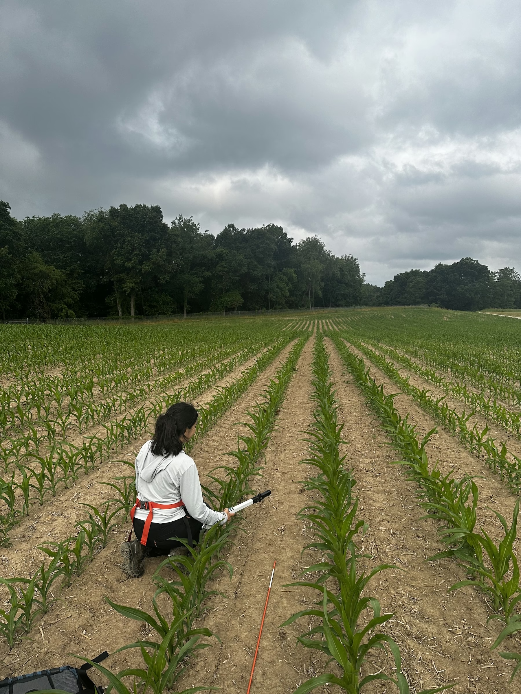
Right: Mahya (me) measuring LAI in a corn field during the two-year field campaign (summers 2022–2023) I led at the Kellogg Biological Station, Michigan.
Did you always know that you wanted to study Earth science and hydrology?
Not at all. I loved math in high school but didn’t have a clear career in mind. In Iran, admission to public universities is determined by a highly competitive national exam; doing well allowed me to attend Sharif University of Technology, where I chose civil engineering because it felt closest to real-world challenges—from structures and geotechnics to hydraulics and water resources.
During undergrad I discovered hydrology and pursued it for my master’s, then worked in industry on hydropower design and dam water allocation—critical tasks in a semi-arid country like Iran. The work mattered, but I wanted to dig deeper into the science behind water decisions. That curiosity came from seeing how often high-stakes allocations in semi-arid Iran—among agriculture, industry, households, and environmental flows—rested on sparse data and large uncertainties, especially during drought. I wanted tools that could close those gaps and make choices more evidence based.
The turning point came in Italy as a visiting researcher at CNR-IRPI with Luca Brocca’s group. I’d learned about remote sensing in class, but this was my first time using satellite observations in research—estimating irrigation water use from AMSR-2 soil moisture. It was eye-opening to see satellites illuminate irrigation, which accounts for the largest share of global freshwater withdrawals but is difficult to measure on the ground. That experience shifted my path—from managing water on the ground to studying it from space—and ultimately toward Earth science.
With geospatial foundation models (GFMs), we showed how to learn from limited ground data to develop a generalized model for a large scale—turning what seemed impossible into practical methods.
What aspect of your work excites you the most?
Two things: turning code into decisions and building with partners. I live in Python—training deep learning models and wiring geospatial pipelines—and there’s real joy when a tough bug vanishes or a model finally holds up on new data. But what truly energizes me is when that work helps someone decide what to do next. Recently, through the Freshwater Challenge core partners, a colleague at Conservation International asked for rapid input as South Africa finalized its UNCCD Land Degradation Neutrality (LDN) targets. We distilled the evidence into a short, country-ready note so decision-makers could add a freshwater dimension before the deadline—that kind of real-time impact motivates me.
I’m equally energized by co-design with end users—asking, “What decision will this change tomorrow?” From USDA NRCS to NGOs, we tailor maps, briefs, and APIs to their workflows and timelines, with clear uncertainty and predictable updates. That fast loop—code → evidence → action—keeps the work challenging, varied, and meaningful. I also enjoy cross-sector builds: right now I’m coordinating between NASA and Microsoft to deploy a hydrology “copilot” powered by NLDAS-3 (North American Land Data Assimilation System, Version 3: an hourly, near-real-time, gridded reanalysis of surface meteorology and land-surface states for North America)—translating across research, product, and engineering “languages” to turn science into a tool people can use.
What scientific challenge intrigues you the most?
I’m intrigued by how to turn the world’s vast unlabeled satellite archive into trustworthy, timely guidance for water and ecosystem decisions. The big puzzle is moving from pretty maps to actionable cause-and-effect: if we restore this riparian reach, how much might chlorophyll-a or turbidity improve, where and when, and with what uncertainty—all while climate and human behavior are changing.
To get there, I’m excited about combining geospatial foundation models (that learn from unlabeled data) with traditional Earth observation and process modeling. The aim isn’t just correlation; it’s credible “what-if” estimates that planners can use—expressed with clear uncertainty, validated against observations, and shared openly so others can test and build on them. In short: teaching AI to read Earth from space, then translating that insight into decision-ready guidance.
What is one space mission that you are particularly excited about, and why?
NISAR (the NASA–ISRO Synthetic Aperture Radar mission). My Ph.D. revolved around SAR—two years of field campaigns in maize and soybean paired with Sentinel-1 C-band SAR (12-day repeat) revisit time to estimate vegetation water content (VWC). NISAR’s L-band can help with the limitation of SAR C-band in dense canopies since it penetrates vegetation more deeply and is highly sensitive to structure and moisture, delivering all-weather, day-night observations ideal for riparian corridors, floodplains, and wetlands. I’m especially excited about the integration of C and L band (Sentinel-1 + NISAR), which can sharpen retrievals of VWC, biomass, inundation, and post-restoration change, while NISAR’s routine global coverage will help train geospatial foundation models on unlabeled SAR, turning the archive into decision-ready information. This matters directly for my work: it builds on my VWC research in agriculture and powers my current efforts to map forested riparian zones and wetland loss—where high-resolution L-band is the key missing piece that NISAR will provide.
What do you like to do in your free time?
I’m happiest outdoors—hiking and camping in the woods. There’s something restorative about carrying what you need on your back, pitching a tent, and spending a night under the trees, especially with friends or colleagues. As a weekly routine, my husband and I take our little one, Aiden, on nearby Maryland trails—Rock Creek Park and Patuxent Research Refuge are favorites—so he grows up feeling at home in nature.
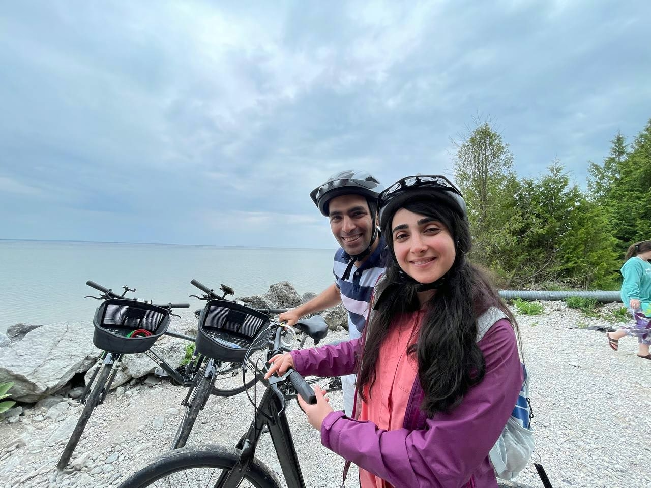
Before Aiden was born, biking and indoor climbing were weekly staples for us; we’ve recently added them back into the mix now that he’s big enough to join.
At home, I practice piano most days, and lately Aiden has started “joining” me at the keys. Our short mother-son duets have become a favorite way to wind down and keep music part of our family routine.
Published Date: Sep 30, 2025.
Hometown:
Tehran, Iran
Undergraduate Degree:
B.Sc. Civil Engineering, Sharif University of Technology, Tehran, Iran
Post-graduate Degrees:
M.Sc. Civil Engineering, Water Resources Management, Sharif University of Technology, Tehran, IranPh.D. Civil Engineering, Michigan State University, East Lansing, Michigan, USA